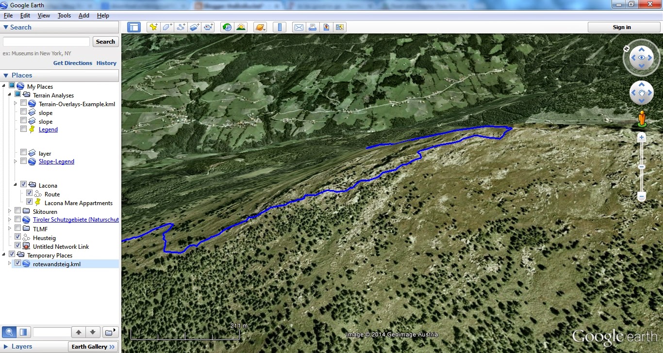
# get OSM data
library(osmar)
library(maptools)
rotewandsteig <- get_osm(way(166274005), full = T)
sp_rotewandsteig <- as_sp(rotewandsteig, what = "lines")
# convert to KML
kmlLine(sp_rotewandsteig@lines[[1]], kmlfile = "rotewandsteig.kml",
lwd = 3, col = "blue", name = "Rotewandsteig")
# view it
shell.exec("rotewandsteig.kml")
26 Sept 2014
Make a KML-File from an OpenStreetMap Trail
Ever wished to use a trail on OSM on your GPS or smartphone? With this neat little R-Script this can easily be done. You'll just need to search OpenStreetMap for the ID of the trail (way), put this as argument to osmar::get_osm, convert to KML and you're good to go!
22 Dec 2012
Convert OpenStreetMap Objects to KML with R
A quick geo-tip:
With the osmar and maptools package you can easily pull an OpenStreetMap object and convert it to KML, like below (thanks to adibender helping out on SO). I found the relation ID by googling for it (www.google.at/search?q=openstreetmap+relation+innsbruck).
# get OSM data
library(osmar)
library(maptools)
innsbruck <- get_osm(relation(113642), full = T)
sp_innsbruck <- as_sp(innsbruck, what = "lines")
# convert to KML
for( i in seq_along(sp_innsbruck) ) {
kmlLine(sp_innsbruck@lines[[i]], kmlfile = "innsbruck.kml",
lwd = 3, col = "blue", name = "Innsbruck")
}
shell.exec("innsbruck.kml")
26 Jan 2012
A Short Example with R-Package osmar..
ps: You can also find this example at GitHub HERE.
osmar - Don't Miss this New R-Geo-Package!
The osmar-package enables you to retrieve all geographic elements of OpenStreetMap via its API.
I.e., you can retrieve a street, river, state-boundary or whatever and use this as a spatial object in R.
It's overwhelming thinking of the endless playground that is opened for R-users by this package!
And, owing to altruistic R-package authors (like the ones of osmar, Thomas Schlesinger and Manuel J. A. Eugster) the oligarch's (ESRI) power evermore crumbles away..
I.e., you can retrieve a street, river, state-boundary or whatever and use this as a spatial object in R.
It's overwhelming thinking of the endless playground that is opened for R-users by this package!
And, owing to altruistic R-package authors (like the ones of osmar, Thomas Schlesinger and Manuel J. A. Eugster) the oligarch's (ESRI) power evermore crumbles away..
Subscribe to:
Posts
(
Atom
)